
Do you think the oil spill in the gulf will kill...

Saturday, May 30, 2009

compacted storm photos


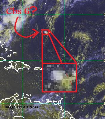
This is a very tiny storm that I found, but it is also strong for it's size; 10 knots. It will likely strengthen, but will remain too small to notify other people about it's strength, and how it would probably will strengthen to hurricane strength unless wind shear develops. If it does, it will rip the infant storm apart immediately because of it's size.

Friday, May 29, 2009

The storm will not go on

Td one is now over colder waters, and I don't think it will strengthen anymore.

Thursday, May 28, 2009

I was wrong


Td one has now regained it's shape, and is going to strengthen to Ana this morning. I'll give an update on that.

Lumped idiot


Instead of a storm with well defined circulation, I see a mess; it doesn't even look like a storm! Noaa, might as well leave this one alone, I don't expect this to turn into a tropical storm.

(to think I was up all night waiting for Ana,...)

TD ONE?!


I didn't expect this that much. What are the chances of having THREE off season storms in a row, almost nothing. Anyway, by this evening, it will be tropical storm Ana. This poses almost no threat to Canada, because I think it will only last three days.
Also, something in the gulf is starting to brew up a storm from an MCS from yesterday. This will likely fizzle before anything, but it will bring heavy rain to the southeast for the next day or two.

cbs5 fizzles, 91l forms and has tropical status


That's right, 91 has tropical; uhh, not quite yet actually. But if you look at the loop, this storm has characteristics of a tropical system. It puffs out in strength, it spins, it even has a spiral arm. This system has a 60% chance of forming into a depression, out of that, an 80% chance of a storm forming, and of that, a traace percent of hurricane status.

Wednesday, May 27, 2009

South Atlantic wave fizzles but is now possible threat to North atlantic


The south atlantic name idea was a crap effort, but it did make a not crap effort to have it's strongest part travel into the Atlantic North. Now in less wind shear, Cbs5 has a higher chance of gaining storm status. It's not much yet, but in this area, it could travel northward, and from the spin of the waters, turn into a storm. There is a 1% chance it will do this.

Tuesday, May 26, 2009

TD1 not really TD1; also, a south atlantic cyclone?

It turns out, I was wrong. Td one was just an area of low pressure. However, it was considered a tropical low by the weather channel. I don't even believe it; for all I know, it should have been named tropical storm Ana, because, it had winds of a recorded 45 mph; that's tropical storm strength. It had good inflow and outflow, and it was lasting for at least long enough for them to notice it.

Another top story; it's late season for this hemisphere, but there might be an area of low pressure that's threatening Brazil. It's four degrees south of the equator, in low wind shear, moist tropical climate over it, and a warm water of 30 degrees celsius under it. The only that stands in it's way is the history of south atlantic tropical cyclones; there are not many that form there. In fact, only three tropical storms ever formed there (I excluded a tropical depression and a subtropical storm). Of those, only one has reached hurricane strength; Aldonca is it's name. But to avoid confusion, I'll come up with a naming scheme for the South atlantic:

  • Abrew (ay brew)
  • Beth (Beth)
  • Charlen (char len)
  • Drake (jra ke)
  • Evangen (ev en gen)
  • Faina (fah ean uh)
  • Gerean (jer en)

This list of names will be given to tropical cyclones that are at least depression strength (30mph) and will be replaced if that storm took landfall. This list started 2009, in May, so the storm list will either start from the storm I'm tracking right now, or in the 2010 South atlantic cyclone season. The length of the season is short; January to April. Typically, most are in the late january.

We'll be watching it closely. Bye!

Saturday, May 23, 2009

THEY missed this one!


CBS4 has become Tropical depression One, and I could tell from the imagery One was there from the way it puffed up just before landfall.

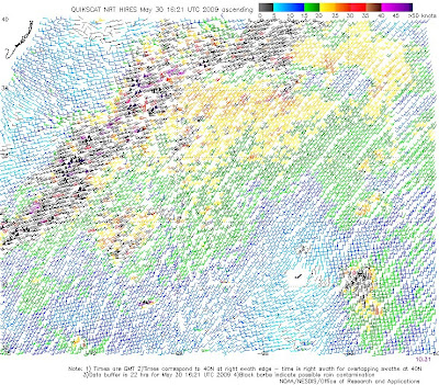
When I saw this, I was stunned. The QuikSCAT imagery showed depression force winds very near it. For Waha, Tropical depression One could have been Tropical storm Ana, but since it is overland now, noone will ever know for sure.
At the end of the month, I'll bring a video about this missing storm. Until Noaa hears about this and declares it a Tropical storm or more, this storm will be named "The Florida storm of 2009."

Thursday, May 21, 2009

This storm is being wierd. If you look at this video, 90 is still raging over cold water. I don't know how it can do this, but it is, by Waha, officially protoAna. All it needs is more cloud coverage to be declared Subtropical storm Ana. As it does so, it will either landfall into Louisiana, or fizzle out trying to survive the wind shear it awaits four days after right now...

Oh crap! I can't get my video uploaded. If you want to see it, go on google and type "storm number one 2009". It might not be there, though. Don't look for it on youtube. I'm not allowed there.

Wednesday, May 20, 2009

CBS4 is weakening


After four days, cbs4 is weakening because of 2 factors:

1. There is two eyes of the storm. They are merging, but very slowly merging while doing so.

2. This is something called the rainfall effect. Storms typically have very cold rainfall. As tropical systems use up the evaporating warm water needed for tropical development, they rainfall colder water. Storms can't exist off of this water, and, if staying still, they weaken or stay the same strengh. This is why hurricanes can't go over a certain speed limit in wind speed.

As the storm gets it's lower level eye and it's upper level eye merged, it's OCOC (overall center of circulation) will start to expand, and lets consider the trades are eventually going to move to unused warm water, and by then, there is a forty percent chance it will turn into a tropical storm. If it does so, it will be named "Ana".

It has dropped in air pressure from 1008 to 1006.

Tuesday, May 19, 2009

Tropical storm formation is expected


Invest 90 is merging with the other storm, and this could cause the damage of major flooding.
The risk is high because as the passing nor'easter is absorbed, it will no longer follow a jet stream, and then the tradewinds take control of the storm and, because of the warm waters, strengthen to tropical storm status. It will then be driven into Florida in the next four days (maybe five, waha isn't ceartin).

Two areas of development

On the left, you will see an extratropical storm just waiting to form. If it passes through the gulf stream, it may pose a threat to Maine or New Brunswick (or any other state that borders them). By the look of it now, it's landfalling into Florida. It will pass over the peninsula, I'm sure, even though it stalled 12 hrs over the exact same spot. This storm will probably shatter, but there is a chance that it will transform into a tropical system.
On the right, the so called invest 90 has the biggest chance of turning tropical, and possibly, landfall into Florida.
On the other hand, Waha is using Noaa images on Google earth so that at the end of the year, you can see the entire 2009 hurricane season. This will potentially go on Google Video, getting more people to log on to this website.

Tuesday, May 5, 2009

Cbs3 is strengthening, Cbs2 not giving up

I'm not suprised. Cbs3 strengthened.
It still is, but a cold front that's coming in 5 days had better step it up if it is going to stop this storm from forming a tropical storm.

Monday, May 4, 2009

CBS1 fizzles, but 2 more things to watch

Cbs 1 is long gone, but CBS2 & CBS3 have now formed, one of them a threat to bermuda. These have a near flawless chance of forming a tropical storm. The only flaw is, they are both over cold water. I'll be back this evening.

Sunday, May 3, 2009

This will shock you; Could-be-ana/andres!


Holy crap!!!
Could-be-Ana-or-Andres!
This souns obsurd at this time of year, but here? AGAIN?! (This happened with 2008's Alma.) Seriously, this is a strange decade. Can the 00's get any... well here's the forecast.
cbs (could be storm) 1 has a sixty percent chance of fizzling off, a 30% chance of turning into Andres, a 9% chance of turning into Ana, and a tracing 1% it will be both, which happened last year. I will be SHOCKED if history repeats itself.
However, if it does develop into anything serious, well i'll do it reguardless if it does, actually, I'll have another post by nine tonight. This is Waha, signing off.