Do you think the oil spill in the gulf will kill...

Sunday, November 8, 2009

Ida is a cat. 2!


Okay, I think this storm is coming out of hand. Where it is now, most people predicted only 50 mph winds, but it is doubled that! With that, WAHA is predicting Ida to stay in the gulf of Mexico for three more days, until the front right next to it will sweep it across Florida. As it does, it will become extratropical. With that being said, get in mind that this is a slow storm. Starting from the southwestern caribbean, it took five days to get where it is now.

As it was crossing Nicaragua and Honduras, some of its clouds traversed eastsoutheastward into El Salvador. This caused major flooding there, and as many as 54 people are dead. If there's 54 there alone, plus those lost in other countries, plus the USA landfall to come, I wouldn't be surprised if Ida is a retired name by spring.

Friday, November 6, 2009

almost 4 hrs in now

gettin hard

Now starting LTR

LTR is the Liginiment Typhology Research. Okay, typhology is a made up word, but I see it as the study of tropical cyclones.
For 36 hours straight I will be using images of the atlantic, from Noaa, amd at the end I will put the images together and find a way to predict hurricanes two weeks into the future, being as accurate as today's 1 day forecast. This is the first of six times that this is hapenning, the next two? One's in december, the other in either march or april.

Wednesday, November 4, 2009

Ida forms

Well, here it is. Ida has formed, and is threatening Nicaragua. I repeat, Nicaragua has a Tropical storm alert. You might want to plan where you evacuate; and fast if you haven't even started yet. Make sure you have 3 days or more of inperishable food and water. Also, if you are in the storm, and a person just happens to go through the window (from the other half, this only happens if the eye is over it and it moves away suddenly and gets caught in the wind), and has no pulse, it is possible to save that person with a defibrillator. Keep away from windows, because a window that is not covered by wood is asking for pricey fixes, and instant death. After Ida hits Nicaragua, there is also Florida on the line, possibly getting a maximal tropical storm or minimal hurricane. I repeat, Florida has a Tropical storm advisory. You might...the hell with it you don't want to hear it all again.
In case you're wondering why it doesn't look like anything that's going to affect Florida, it's because it's going sooooooo slow! By the way, I thank Noaa imagery for making it's picture available on google Earth possible.

Tuesday, October 20, 2009

Invest 94L

centered in the image

Monday, October 5, 2009

ARE YOU ****ING SERIOUS?!


Grace has formed-up there! I'd never thought it could happen under only 17 degree waters, which is terrible for tropical storms. It'll die off by morning (i think).

Saturday, October 3, 2009

Tropics seem very quiet...

I'm bored. Just in case you were wondering, there is a new fail site hosted by Epic Fail at http://youhavegotfail.blogspot.com

Saturday, September 26, 2009

TD eight will dissipate, test on December 1

On december 1st, I am going to risk my entire blog by creating a Youtube account. Also, TD8 has formed, but pay no attention, it will be gone by this morning.

Sunday, September 13, 2009

Google Earth lied!

I can't get the image up.
sorry

Saturday, September 12, 2009

Meditteranean storm?

On my next post, I will show an image of what I am talking about.

Wednesday, September 9, 2009

Fred is a cat. 3


Major hurricane Fred is not a threat to land, but is still interesting to track.

Fred is NOT a cat 1


Fred is now a cat 2 storm. Points are 6 hours apart. While Fred is moving NW at the moment, it will make a recurve to the WSW after three days or so. However, the upper part of the storm will go away, so I predict that it's not long until "storm go bye bye".

Tuesday, September 8, 2009

Fred


Sorry that I couldn't give you an accurate forecast on the last post. Anyways, it is a tropical storm right now, of 70 mph.
Hours Strength
6 75
12 85
18 95
24 100
30 100
36 90
42 75
48 65
54 50
60 40
66 35
72 30

Fred


96L has become Fred. I can't give an update in full to you right now, but I will give it to you in just a few hours. I don't think it will become anything that will threaten land, though.

Monday, September 7, 2009

96L and my youtube account problems

96L has formed, and is looking very healthy as a storm, yesterday, anyway, If it does become a tropical storm, it won't get very far because of wind shear.

Also, a problem forms with Waha. It has to shut down eventually because it is so big. So, I am trying to make a new account on Youtube, so that I can post more things. I can even post the videos of my Google storm tracking. However, I need to verify my email adress. They were supposed to, but didn't, send an email to me to verify the account. So I checked Google help, and it showed me three possible solutions. 1 and 2 didn't help me a bit. 3 is the only possible answer left, but it might destroy this blog. Will it? Please post your answer on the comments section.

Friday, September 4, 2009

erika is dead, 94l alive, chance of youtube account thriving.

94l is in the central atlantic, now rapidly strengthening. I'd say Fred will form from this system.

Also, I am back allowed on youtube, and I am running out of blog space, so in December Waha will shut down, and I will allowed to post on youtube, hopefully. I can put loops on that website, since I can post videos, but just in case, I am going to upload a video of Hurricane Bill if possible on this post.

Sorry, I can't.

Tuesday, September 1, 2009

erika forms and is starting to threaten Georgia


Erika has formed and is going to actually have a shot at landfalling as a hurricane in Georgia. There is a lot of warm waters, however, it's not going to strengthen that much because of the windshear from Major hurricane Jimena. Another threatened areas include* Anguilla, Puerto ricco, D. Republic, the Turks, and the Bahamas.
*not limited to

Saturday, August 29, 2009

Danny will cause a lot of flooding


Tropical depression Danny has merged with a frontal system, and will pprobably be very dangerous for people in New England. Take extreme caution.
As for 94L, it has a seventy percent chance of becoming a tropical cyclone in the next 48 hours. In fact, I think it might be more than that. All it needs is to stick to having clouds, and to get stronger by just ten knots, and it will be a tropical storm!

Danny is almost gone

There's not much to say about Danny, it was torn apart by wind shear, and 94L will probably become Erika. I'll make a post on 94L today.

Wednesday, August 26, 2009

Danny


The huge area of showers and thunderstorms are actually Tropical storm Danny. Danny's path of where it will be, all computer models say it will be a fish storm, but I think there's a 20% chance of being driven into N. Carolina, as a strong tropical storm, or a weak hurricane. But if anything, Canada will have a huge storm coming it's way.

Danny

Look at the link that leads you to the Noaa website, and click it. You will probably think that isn't a storm, but it is. Also, notice it is aimed for Florida, but it will recurve. Poor Canada, they have to face TWO storms in one year!

Monday, August 24, 2009

Bill has left us


Yesterday, I went bodyboarding, and I have to say there was a lot of big waves. Bill has made waves 10 feet high, and I have to say it was awesome riding them. But in the Northeast, this means bad things. At least 25 people were killed, and this was also Bermuda's third wettest storm ever. So, this was a bad storm and I think Bill's name is going to be retired.

Sunday, August 23, 2009

Bill slams Nova Scotia, Newfoundland is next

If you log on to http://www.ssd.noaa.gov/goes/east/nwatl/flash-ir4.html, you will see Bill is about to pound Newfoundland as a hurricane. Newfoundland is not use to hurricanes because nothing has hit there in years, so this will be a wake up call. Bill has already sent 20 out to sea, and from them we can only expect the worst; death. A few might be safe, but that would be about it.

Saturday, August 22, 2009

Hurricane Bill weakens


I guess it was far away from Bermuda, but still dealt it woth some storm force winds. I hope that it was useful to heed the warnings that I gave. Canada is next, and will still bring some hurricane force winds. I repeat, Nova Scotia and Newfoundland has a Hurricane advisory. You might want to plan where you evacuate; and fast if you haven't even started yet. Make sure you have 3 days or more of inperishable food and water. Also, if you are in the storm, and a person just happens to go through the window (from the other half, this only happens if the eye is over it and it moves away suddenly and gets caught in the wind), and has no pulse, it is possible to save that person with a defibrillator. Keep away from windows, because a window that is not covered by wood is asking for pricey fixes, and instant death.
I will record the landfall of Bill on my computer, and at the end of the year, post it on Youtube (hopefully).

Friday, August 21, 2009

Bill narrowley missed


Bermuda just barely missed Bermuda. So, if Bermuda isn't in the danger zone, then Canada is in it. Canada will likely get hit as a cat. 2 hurricane.

Wednesday, August 19, 2009

Bill very close


Major hurricane Bill is still putting Bermuda at a high risk. I repeat, Bermuda has a Hurricane advisory. You might want to plan where you evacuate; and fast if you haven't even started yet. Make sure you have 3 days or more of inperishable food and water. Also, if you are in the storm, and a person just happens to go through the window (from the other half, this only happens if the eye is over it and it moves away suddenly and gets caught in the wind), and has no pulse, it is possible to save that person with a defibrillator. Keep away from windows, because a window that is not covered by wood is asking for pricey fixes, and instant death. An evacuation plan is a more necessary plan, though.

Bill will be a cat 5


All the conditions are correct, and the closer Bill gets to Bermuda, the stronger it becomes. Which is bad for bermuda, because, well, obvious.

Bill is a cat 4


Major hurricane Bill has really done it now. Sorry about all those Bermuda warnings, but I still think you'll get a lot of huge waves that could bring rip currents.

Tuesday, August 18, 2009

Major huricane now


Hurricane Bill is no more; hello Major hurricane Bill. This major hurricane still has Bermuda in it's crosshairs. I repeat, Bermuda has a Hurricane advisory. You might want to plan where you evacuate; and fast if you haven't even started yet. Make sure you have 3 days or more of inperishable food and water. Also, if you are in the storm, and a person just happens to go through the window (from the other half, this only happens if the eye is over it and it moves away suddenly and gets caught in the wind), and has no pulse, it is possible to save that person with a defibrillator. Keep away from windows, because a window that is not covered by wood is asking for pricey fixes, and instant death.
Now that this is a Major hurricane, I think a lot of Bermudans have no choice, but to evacuate, or ride out the storm. I'd perfer evacuate, because this will be a cat. 4 hurricane hitting Bermuda. Be warned.

Solid eye

The "All Google Earth" promise is officially broken, but I will do google earth every once and a while. Bill now has a solid eye, enabling it to even more rapidly strengthen. Again, it will hit Bermuda.

Bill strengthened but still not a cat. 3

I am starting to think that there will be no landfall into bermuda. It has started to recurve already, and it's thousands of miles away. I'd still say that all that bermudans need to prepare for will be necessary, because it might be taking a straight path. A lot of hurricanes do this, catching a ton of people off guard. So, still be warned.


About to kick off the first major hurricane


Bill looks like he is about to become a Cat. 3 hurricane. Remember, it's heading for bermuda.

Bill is huge


Bill kinda looks like Andrew now, with that familar eye. Now that the eye is cracked open wide, it's strength can skyrocket. I think it will turn into a category 4.

Look!


Hurricane Bill has formed an eye. This will allow it to strengthen a lot more quickly. Bret, a hurricane of 1999, is a good example. While it was forming, Bret formed an eye while it had 45 mph winds, causing ot to become a cat. 4 hurricane in less than two days. This danger was narrowly escaped, because so many people evacuated, and it landfalled as, well, actually, it was only because people evacuated. I expect this to hit bermuda.

Monday, August 17, 2009

Bill has strong winds


Hurricane Bill: this is a deadly storm. This update is for starting to watch it rapid strengthen.

Big bad Bill is going to kill


I really do feel guilty to not use Google Earth after I said I would; it's just that this is a stunning picture, and would be perfect to put on this blog. Also, by looking at this picture, I would say that it is going through a rapid deepening. A rapid deepening is a process in hurricanes where the strength goes up, and pressure goes down, but at the same time very abrupt. A good example would obviously be Major Hurricane Wilma, which went from a tropical storm from a Cat. 5 beast in just 24 hrs! Something else that is interesting is the fact that GDFL predicts this hurricane will become a Cat. 5 hurricane, and at the same time, predicts that it will totally "kill" Bermuda 48 hrs later. Bermudans, if you want to get prepared for this storm, just look at the update that I made previously. It will probably hit Bermuda in 114 hrs. or less, but I'd say the waters are too cold to support a category 5 hurricane. Maybe it will hit as a Category 3 or 4 hurricane, but it definitely won't be happening as a category 5.
Claudette
This storm has taken landfall on midight of last night. How much rainfall, I think there was at least six inches at the highest areas, probably a lot more, because the heavy thunderstorm activity has hung below the system since this storms' third advisory, which probably poured down on Franklin County, FL, with an estimated total of 8 inches. Unless it does any funky loops, I think we don't have to worry about this storm, as far as I know, but just in case, take caution.
Ana
Tropical depression Ana is struggling to stay alive. I'd say that it wouldn't last four more days, but it's remnants will sure rain down on the greater antillies.
That's all I have to post for now, I'll post again at 8 o'clock or 15 minutes antiprior to that time.

Bill the devil


Bill is now a hurricane of 90 mph, and is strengthening rapidly. I expect it to turn into a category five and then come close to Bermuda, so close that it might actually hit bermuda and come ashore with 135 mph winds, Category 4 force. This will probably happen in about five days. If it does this, I will give hour by hour coverage. I repeat, Bermuda has a Hurricane advisory. You might want to plan where you evacuate; and fast if you haven't even started yet. Make sure you have 3 days or more of inperishable food and water. Also, if you are in the storm, and a person just happens to go through the window (from the other half, this only happens if the eye is over it and it moves away suddenly and gets caught in the wind), and has no pulse, it is possible to save that person with a defibrillator. Keep away from windows, because a window that is not covered by wood is asking for pricey fixes, and instant death.

Sunday, August 16, 2009

Videos?

sorry i can't post videos for this website. But starting October 20 I might be able to do that with youtube.

TS Claudette tricked us

now heading WNW. Tried to get a loop up, try to find it on google videos.

ABC's

I don't have time to make an update right now, so I'll just give you useful loops.
Here is the full atlantic loop, and these are floaters of the atlantic basin. Claudette has formed and is about to take landfall.

TD FOUR TOO?!?!


Yes, the impossible happened; three storms at once, one of which is ANA! Well, I guess I said Ana first, so I'll tell you that in the next six days, it will likely take landfall in Florida as a tropical storm. But first, within the next 48 hrs, the upper lesser antillies will get battered a ton. But that will possibly only be a warm up call, because Bill will likely turn into a dangerous Cat. 2 hurricane. After that, Jacksonville's people need to evacuate a cat.3 storm. I am no extremely good expert, but, I'd say Jacksonville will be half leveled within ten days. And Four, it is likely to turn Claudette (I can't believe that's true, $%@# it). It will probably do minor amage, but might loop so be warned.

Saturday, August 15, 2009

Bill Nye the science guy! LOL

Not only have we Ana, but also have we Bill? Yes, that is true. I can't remember any season with the first named storm and the second named storm intercepting each other timewise. But that record has now been broken for the atlantic for sure for all I know. Anyway, the forecast for Ana goes first: every yellow line represents a day or so. This tropical storm is now making Tropical storm watches for the upper lesser antillies (places close to Antigua). And that all-ridiculous thing that happened; Bill. When it formed, it had me singin' "Bill Nye" for hours to come. Anyway, this storm is only 2 days behind Ana.

Remnants of TD2 become Ana

The storms above: one tropical storm, and one invest (with the big L on it). Other people we're caught off guard with the center of the storm. But our motto is: we never stop tracking it until it is officially dead and gone! Possibly by the end of tomorrow, I can be allowed back on Youtube, enabling me to make forecasts there, too. Tracking this storm was tough when it was a remnant low, in fact, some points I am not even sure that they are correct. But it will have to do, besides, that storm could have had a "face storm" when a storm has two eyes instead of a cyclops storm, which is common in storms and has one eye. Anyway, the wave behind it might have a chance of hitting FL, I am nervous because I LIVE in florida (though I am not giving my name away, that will stay anonymous)! That might mean no more blog.
Well, I'll check in with these storms a little later in the morning toay.

Friday, August 14, 2009

TD2 dies but is regenerating

Just letting you know. I am still tracking it's remnants.

Thursday, August 13, 2009

2 dropped south, so is now a threat to the eastern states

Tropical depression two has weakened a wee bit as it starts to head south. So as it heads south, it becomes more threatening to the caribbean sea, The bahamas, and Florida as well. We will be closely monitoring it's movement.
I'd say Invest 91 is about to form into something. Just before Two formed, it's precursor wave was extremely sloppy. So expect formation within the next 48 hrs.

Wednesday, August 12, 2009

2 before the 8

Click on the link on one of the poevious links for floater one, which leads to TD two. I think a tiny bit of clouds dissapearring is a sign that it will strengthen again if it is over warm enough waters. So, by this evening, there will be a post on Ana, if it forms.

100th post means Google Earth from now on

Here's to Google Earth's reliability. It is up and running again. Anyway, the forecast for the atlantic is that there will officially be Tropical storm Ana by 8:00pm eastern daylight time. It is not threatening any land right now, because it is forecast to become a fish storm.
The wave behind Td Two is invest 91, which the GFS thinks will just barely hit land at Cape Fear, NC, and Long Island, NY. If that happens, I will seriously owe them one. They have been crappy all year, but for this storm just might turn into a Cat. 3. I will post again after 2:00pm.

Two will become a TS guarantee

If you click on the O, you will get Floater 1, which is monitoring Two right now.
O

TD Two still out there


This storm has been stalling to get Ana. I am positive that in the next advisory, she will shine.

Tuesday, August 11, 2009

Ana is on the way


Well, here it is; TD Two. Right now it's wind speed is 30 mph, traveling west. In my opinion, I think this storm could go many different ways. The best chance track it will take would probably be in this picture. I think over time, it will be a TS on the 2am advisory Wednesday, and then take a slight recurve to westnorthwest. Thursday on the 8 am advisory, we could see a hurricane. Friday at that same time, it will possibly be a category 2 hurricane, and start to track due west. 2am advisory on Saturday, Category three, and starts to take baby steps to the north with it's west track. At 8pm, it will probably weaken to a category 2 on Sunday. At 8am Monday, it will get downgraded to a Category 1, 2am Tuesday, it starts to head Northeast as it becomes a tropical storm. At 2am Wednesday, it will become a tropical depression, and become extratropical at 8pm that same day.
If this prediction is wrong, then it could go more north, or more south. Slightly north and it might slam Bermuda as a strong category 2. Keep in mind that about five days ago in the northwest pacific, a typhoon called Morakot totally crapped taiwan, and it was a category 2. So nobody should underestimate hurricanes; especially those of cat.2 or higher.
Slightly south, and Northeast coastal states (includes Newfoundland, New brunswick, Maine, New hampshire, any east coastal state more north than the Carolinas) could be left with a maximal storm or a minimal hurricane. Remember, Agnes was a tropical storm that hit the Northeast coastal states, and not only they, but Penn state (Pennsylvania) as well. Agnes did tremendous damage.
A lot south, and this storm won't be a cat 3 at maximum, but category 4 or 5 because of very warm waters. Remember Floyd, Hugo, and Andrew? They we're all monster hurricanes that hit the Southern coastal states (includes East Florida, Georgia, SCarolina and NCarolina). Andrew may have gone into the Gulf of Mexico and affected Louisiana, but the other two hurricanes that I mentioned would sound like what future Ana could do if it significantly goes more south than forecasted.
I'll keep you posted on TD Two, at 2pm.

99 is TD2...


...and to think this is one hour before the next update! Two is heading westnorthwest, and I think this will possibly take the same path as Bertha did (except there will be no coriollis that made Bertha dip southeast). If this becomes TS Ana, I will track this thing the whole way!

Monday, August 10, 2009

99 & 90


The two invests in the atlantic have we here today. There is 90L (left circle) and 99L (right circle). Let's start with 99L. As you can see in the image that I posted on this site (previous entry), it's starting to go into the images of Noaa. Along with that, convection isn't as strong as it was six hours ago. It is traveling west, and it has a 50% chance of forming into a tropical cyclone.
Now we go to the more interesting part; 90L. It was just declared today, and convection is rapidly firing like a minigun. As it is doing so, it is taking a westnorthwest track, doing so it is also strengthening over the warm waters of the Caribbean sea. Development of 90L, if any, will be slow within the next three days. If it does develop, however, then it will likely hit Cuba as a tropical storm. I am giving this system a 40% chance of development.

Barbados storm is 90L

just letting you know.

In addittion to 99L...


In the image below, there is a barbados storm.


99L has a high chance of forming into Ana

I still can't show you a noaa image of 99, but I will just let you know the first named storm of the year will have a 75% chance of being 99L. According to the SST, thus storm will probably become a hurricane. The bad news, if it forms, is that it will likely hit land, because this storm is taking a similar path to either Maria (hit Iceland), Andrew (hit Florida), Hugo (hit Southern Carolina), or anywhere in between. There are rumors and yingyang and all this crap about "Bill" being behind it. I don't think bill will form. That's too far away anyway to even predict where a storm in the sahel is going, okay? If I am wrong, then might as well bang myself with a rubber chicken 1,000 times!

Sunday, August 9, 2009

Invest 99 has formed

If you look at http://oiswww.eumetsat.org/IPPS/html/MSG/IMAGERY/IR108/BW/FULLDISC/index.htm, you will notice a storm that is spinning over Cape Verde. That storm will likely become TD2 in the next 12 hrs. I will post again at 3:00 pm to keep you posted.

Wednesday, July 22, 2009

98L grows organize, 97L starts to die


If you go to the noaa website, you'll notice there is 97, and 98. 98 is becoming more convective, and I'd say something is trying to form in 98. I'd give a 55% chance of something forming. As for 97, there's only a 25% chance ofr something forming there.


Forecasting news:


Noaa has been actually failing to pay very much attention to the atlantic. Case in point: Should-be-TD One.

For instance, shbtd one had a closed center of circulation, outstanding convection, was warm core, and most importantly, had winds of 35-40 mph, depr. strength-storm strength winds. In addittion to that, 97 had actually 50% chance of forming when it was declared, but Noaa declared that it would actually have no more than 29% chance of forming.

Also, Waha has changed it's name again to Weather in Atlantic Hurricane Association, since the A for Authority made no sense at all.

Tuesday, July 21, 2009

98L forms, 97L still here


In this picture, it's easy to pick out the two disturbances, but which one is which? 97 is the bottom one, and the other wave, the one near the bahamas, is 98. Both are disorganized as it appears, but strangely, 97 has been through heavy shear and it isn't gone yet. In fact, more than half of the computer models say this will go on for more than two days.

But for 98, it just formed hours ago and I think despite it's age, will actually have the chance to strengthen to a tropical storm in three days or more. There is a 45% chance of this.

Back to 97, I have been watching it since it came off africa, but didn't post anything about it, spite the fact that it wasn't an invest, coupled with the fact that waves at this time of year peter out in the blink of an eye. I think this disturbance will not have the strength to upgrade to a tropical depression because of being overland for the next day, and three days later (when it's in less wind shear), it will probably have enough things needed to develop into a tropical depression. However, if this turns into a tropical storm I will be completely surprised.

But here's the thing, if Ana forms out of one of these storms, there definiteley won't be Bill, too.

I'll post again this evening.

Saturday, July 18, 2009

97L


Finally we have something to watch in the atlantic. This storm, also known as invest 97 has been showing a lot of convection during the past three days. Just use this map to see where the storm is going.
If it develops into a tropical system, I think the strongest it could possibly get is a trop. storm.

Sunday, July 12, 2009

nothing in the atlantic, but...

I really want to tell you about tele-existence. Before you get too bored and run away to a new site, i'll tell you that tele-existence is when someone can move a robot with their own movements, and yet that person feels like he/she is the robot. Mind controlled robots can go out of control with one little thought, making them harder to handle. With a tele-existence robot, dangerous tasks like space travel, protecting the city from criminals, or climbing trees cam be done without harm. This would also be good for putting micro-sized objects together, or using a micro-sized tele-existence robot investigate harmful bacteria such as swine-flu. I've been looking forever for anything on tele-existence that didn't require me to read a book. Only three websites took me to where I wanted, which, in my opinion is not enough of them. Only one showed an image of a tele-existence. In the next update I'll show you that image. It was only for the right arm and hand, but that is truly amazing enough to be encouraged to build something like that. Even before I saw that image, I really wanted to build something like that called the RY (robo you). So before I saw the image I thought it could be built by 2015, but because of that image, we might have the technology to build that by 2010! However, my plan was only to have tele-existence to areas above the waist, because if you have to use your legs, that gives an extremely small area for the RY to go because you might run into a wall, then the robot stops as well, you also might lose your balance. So to solve that problem, in the blueprint I plan to put wheels on to the RY, so that you can sit down, and moving your foot back and forth, or side to side, you can control the RY's movement. That way, there's a lot less chance of balance loss of the RY, and no chance of you stopping because interference in your enviornment amd the robot stopping as well when you do not want to do that.
But there's a problem with this. For example when you move your arms up, and there's no ceiling in your enviornment, and yet there is in the RY's enviornment, directly above, then if the arms of the RY touch the ceiling, and you keep moving your arms up, it could recalibrate itself. One possible solution to this would be putting motion sensors on the person moving the RY and the RY so that, in the situation I was typing about in the previous sentence, it can notice when the RY is recalibrating itself, then sends a signal the user to vibrate his legs so that person knows he/she is recalibrating the robot. That way he can know about this recalibration, and then move to another area so that the RY can calibrate itself back to it's origional calibration setting, or, so speaking, tha correct calibration.
If you already know about stuff like this, and would like to show me something that has to do with tele-existence, then show me your blog URL, and post something like the RY concept, because I would really like to see some more bots of tele-existence than just one. Seriously, this annoys me. Also, only post images about it, and if you do use video, don't use youtube, vimeo, newgrounds, or bing. I recommend to you that you use metacafe, if you can. But the whole general point is, please show me something just like the RY (hint: it's about tele-existence).

Monday, June 22, 2009

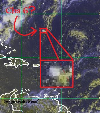
Cbs 11 forms, African dust storm


That time of year is back; summer. For most kids, it is like a dream, but for meteorologists, it is the beginning of a nightmare. Storms start to brew, and there's a chance of people getting killed by hurricanes.
That won't stop us (even though cbs 11 has now formed. Because of land breezes during the night, the southern gulf of mexico has gone from quiet, to containing a system that looks like it's already a hurricane in just three hours. Even though, it still is not forecast to strengthen. There is a lot of wind shear. Right now, there is only an 11% chance it will develop into a depression, of that, 60% chance of Ana from this, and virtually no chance of a hurricane.
Cbs 10 is still brewing, though. However, it will have some time to dissipate.
Now, for the report on this dust storm. It's huge, and it will probably travel into spain.

Thursday, June 18, 2009

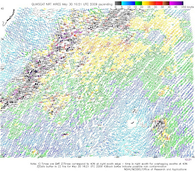
Cbs 10 + equation for Averaged Direction Strength (ADS)


There is an area of disturbed weather called CBS 10, which has a high chance; 60-70% that it will develop into a tropical depression.

However, if you look at QuikSCAT data, you will notice it doesn't look like a storm; just a bunch of lines with the top stronger than the bottom. The reason to this is simply because the storm is moving, not stationary. It's simple to figure out it's spin: the storm's strong end is 35 knots, weak end 10 knots, so if both ends were to be 35, weak end the other way, it would be 35. Take away ten from one end, and that brings it down five knots. Since 35 and -10 are 45 away from each other, that takes off 22.5 knots. 35-22.5=12.5, and you have it's strength. To find out the direction, well, it's 22.5.

Or, in other words:

35=s -10=w 45=d 22.5=D 12.5=e

s-w=d d/2=D s-D=e. Man I hate summer math! This is called the ADS equation.

The bottom line is Cbs 10 has a current strength of 12.5 knots, under shear of about 6 knots. It is under warm water of 30 degrees celsius, which is also 86 degrees celsius in, which is rather a warm eddy of oceanwater, so in the next 72 to 96 hours, development is expected. But at this time, it's not threatening land.

atlantic quiet, the gulf of mexico has been silent for a week straight or more

You'll be suprised on how much the gulf of mexico has been spotless. That's because an area of high pressure is over the gulf, which causes more shear because it's driving the winds downward in the carribean and the gulf of the bahamas, causing for more wind shear. More shear means less percentage of strengh. The storm has then nothing to do but two words: final; glory; and the storm peters out.

Monday, June 8, 2009

Wave expected to not develop


Cbs 8, the wave least expected to develop has good inflow, good outflow, and might turn into TD two, and may be Ana in the next 72 hours. The reason it won't turn into TD one then Ana, is because TD one already happened, but this is a rare phenomeon to have a tropical depression be the first one in the season, and yet it didn't turn into the "A" storm. Has that ever happened in the past in the atlantic? It happened in the pacific, with Tropical depression Agaton 2006, but that was an A storm to the Phillipines. Please post a comment about any of those storms.
I expect it not to develop, but that's just an expectation. The reason for not expecting it to develop is the wind shear, and the low vorticity of this storm.
And one more thing, when a hurricane comes up, I'm going to work so hard for Waha. I'll update this site six times every hurricane day until late August, but then I'll work nighttime.

Wednesday, June 3, 2009

Invest 92


Really? They expect that to be a subtropical storm, which I don't think would be a good idea. There's not enough clouds, sea surface temp, and winds and most importantly too much latitude. Waha predicts this will not form into anything more than another depression.

Saturday, May 30, 2009

compacted storm photos


This is a very tiny storm that I found, but it is also strong for it's size; 10 knots. It will likely strengthen, but will remain too small to notify other people about it's strength, and how it would probably will strengthen to hurricane strength unless wind shear develops. If it does, it will rip the infant storm apart immediately because of it's size.

Friday, May 29, 2009

The storm will not go on

Td one is now over colder waters, and I don't think it will strengthen anymore.